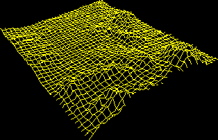
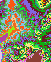
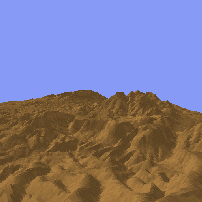
The images above show the USGS 7.5 minute DEM of Beatty, NV as processed by:
All images were processed by Paula Messina, and generated at the
Spatial Analysis and Remote Sensing Lab at Hunter College.
This home page represents an overview of current techniques, trends
and applications of terrain analysis. It is the product of a seminar entitled
Digital Terrain Analysis offered during the fall semester, 1995
at Hunter College of the City University of New York. It was led by Dr.
Keith C. Clarke. I have tried to present current links to information
and software, and a few notes from the seminar. Please feel free to make
comments, suggestions, or submit materials for this Home Page to Paula
Messina, pmessina@everest.hunter.cuny.edu.
![]() Return to Hunter's Geography Department Home Page
Return to Hunter's Geography Department Home Page