![]()
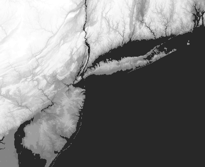
The USGS 1 degree by 1 degree, 1:250,000 scale digital elevation models for the NY metro area were obtained via ftp from http://edcwww.cr.usgs.gov.
The DEMs used were:
These were imported into ARC/INFO using the demlattice command after
having record delimeters inserted using the UNIX command:
dd if=inputfile of=outputfile ibs=4096 cbs=1024 conv=unblock
A latticemerge was performed to create a seamless data layer and
the entire grid data layer was projected into the UTM projection.
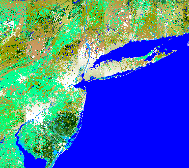
The GIRAS datasets used were:
The GIRAS data was uncompressed using gunzip and imported into ARC/INFO. Some editing of the data was performed to correct problems introduced by processing of the vector data. There will also be a mismatch along the seams of the GIRAS datasets. These are due to various data collection issues. To avoid additional vector data processing errors each GIRAS quad was converted to a grid format and then a latticemerge and projection transformation was performed.
![]() Return
to Hunter's Terrain Analysis Home Page
Return
to Hunter's Terrain Analysis Home Page