Conic and pseudoconic projections
Conic
projections
In conic projections, the parallels are partial
concentric circles. The meridians are straight, equally spaced radii of the
circles. Conic projections usually don't show the entire world; the projection
outline is fan-shaped.
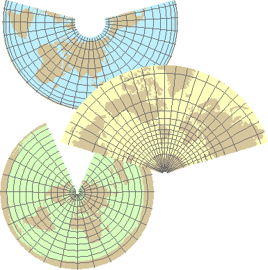
The Albers Equal Area
Conic (top), Lambert Conformal Conic (center), and Equidistant Conic (bottom)
are conic projections.
Pseudoconic projections
Pseudoconic projections are like conic projections in
that their parallels are partial concentric circles. As with pseudocylindricals, the difference is that meridians are
curved rather than straight. (Again, the meridians are equally spaced.) The
outline is approximately heart-shaped.
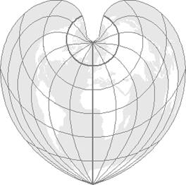
The Bonne projection is pseudoconic.
There aren't many pseudoconic projections; only the Bonne is supported in ArcGIS. The Werner is another that is often illustrated, but rarely used.
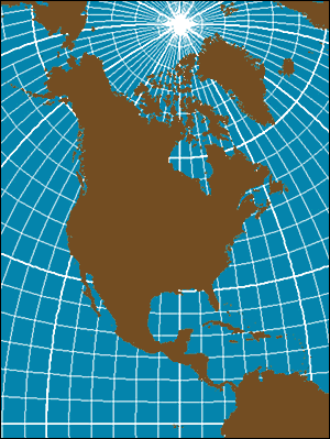
Polyconic projection
Not all map projections use a single developable surface. Conceptually, the Polyconic projection is based on multiple layered cones. It is a non-perspective projection that can only be constructed mathematically.
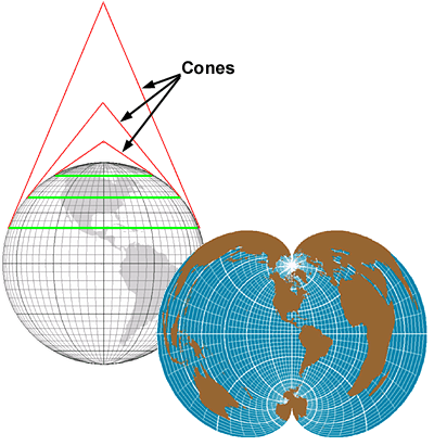
The Polyconic projection is a non-perspective projection that can only be constructed mathematically.
You can see
that the Polyconic map projection is not suitable for
mapping the entire world. However, areas where the map projection is centered
are represented with less distortion (e.g., North and
Learn more about the Polyconic map projection
The Polyconic map projection is believed to have been invented around 1820 by Ferdinand Hassler, the first superintendent of the United States Coast Survey. To Hassler, polyconic wasn't a specific map projection but a methodology for creating map projections. Over time, the term polyconic has, almost exclusively, been used to describe a specific map projection that employs Hassler's methods for creating a map.
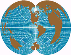
Distortion is
significant in an east-west direction but less along the central meridian. For
example,
The Polyconic map projection's most popular applications have
been maps for North America, not for mapping the entire continent, but for
smaller areas of the world such as a USGS 7.5' quadrangle. For this reason, in
many parts of the world it is called the American Polyconic
map projection.
The Polyconic map projection is neither conformal nor
equal-area. Although distortion can be significant in an east-west direction
from the central meridian, distortion is extremely small for areas near the
central meridian, such as a USGS 7.5' quadrangle. Unfortunately, the Polyconic map projection has been used incorrectly to map
entire states and on occasion the entire conterminous
If you zoom in on