Equitable access to drinking water
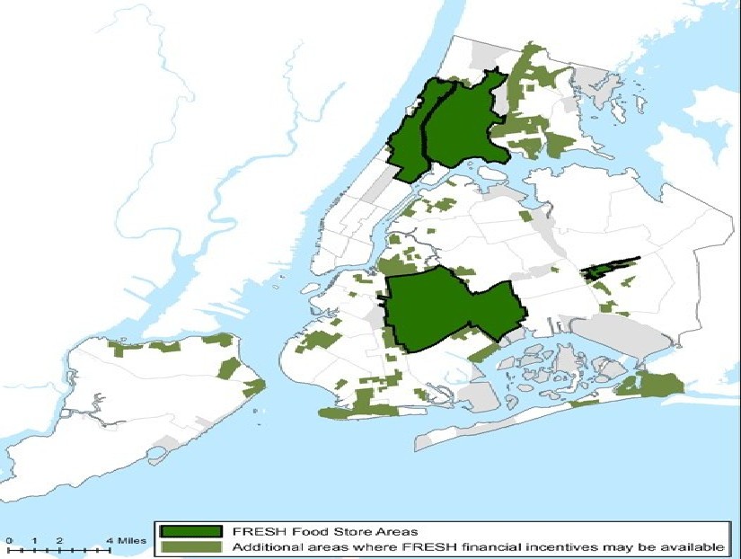
We delineate food desert areas around NYC based on USDA criteria, and use geostatistical analyses to determine if there is any significant difference between outcomes in food desert areas vs. all other parts of NYC.
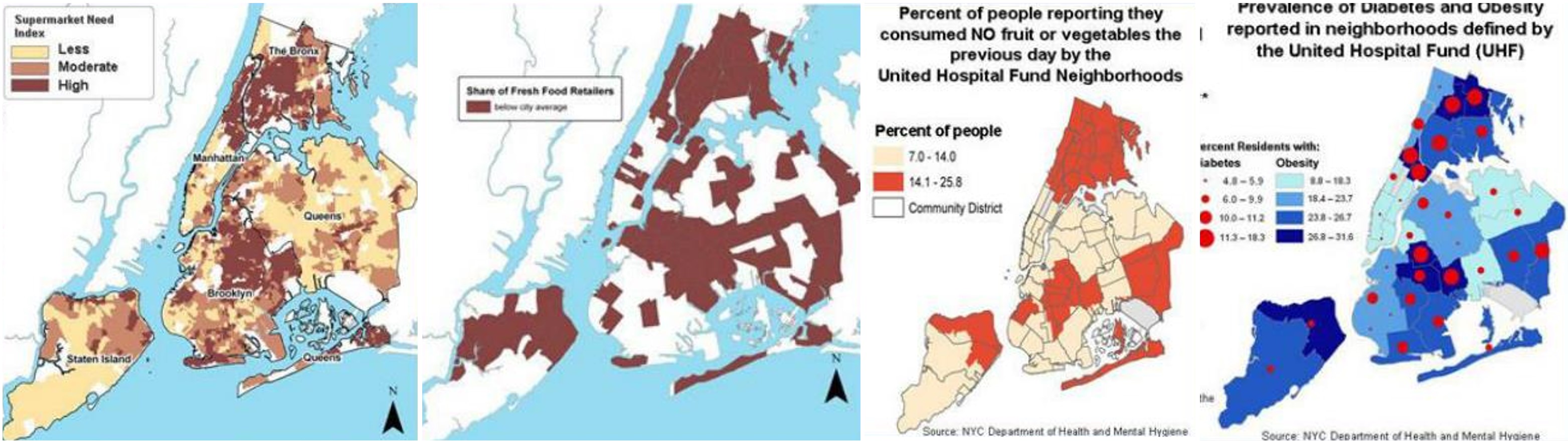
This helps us to understand the spatial distribution of the water quality sampling and survey results. We also use the GIS maps to explore the spatial differences in perceptions of bottled water quality vs. tap water and drinking water fountains in different areas of NYC.