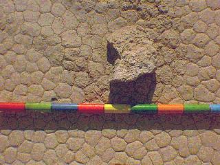
Blanca
(Rock
#126)
 Location (July,
1996)
UTM (Zone
11)
Easting:
450581.96
Northing:
4057852.29
Lithology:
carbonate
Trail Map: July,
1996
Location (July,
1996)
UTM (Zone
11)
Easting:
450581.96
Northing:
4057852.29
Lithology:
carbonate
Trail Map: July,
1996
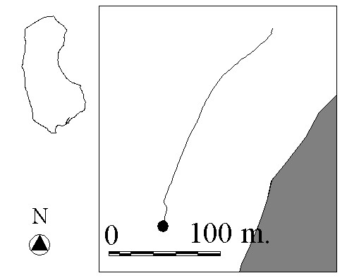 Total Trail Length (July, 1996):
204.13 m.
Distance From Trail Start Point to
End Point (July, 1996): 195.33 m.
Trail Straightness (July, 1996):
0.96
Total Trail Length (July, 1996):
204.13 m.
Distance From Trail Start Point to
End Point (July, 1996): 195.33 m.
Trail Straightness (July, 1996):
0.96
 Go on to the next rock's homepage
 Go back to the previous rock's homepage
 Go back to index