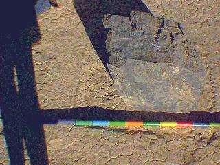
Stacy
(Rock #21)
 Location (July, 1996)
UTM (Zone 11)
Easting: 450032.67
Northing: 4057960.25
Lithology: carbonate
Trail Map: July, 1996
Location (July, 1996)
UTM (Zone 11)
Easting: 450032.67
Northing: 4057960.25
Lithology: carbonate
Trail Map: July, 1996
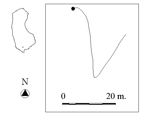 Total Trail Length (July, 1996):
49.28 m.
Distance From Trail Start Point
to End Point (July, 1996): 21.52 m.
Trail Straightness (July, 1996):
0.44
Total Trail Length (July, 1996):
49.28 m.
Distance From Trail Start Point
to End Point (July, 1996): 21.52 m.
Trail Straightness (July, 1996):
0.44
 Go on to the next rock's homepage
 Go back to index